


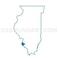
PRECINCT 10, Monroe County, Illinois
About
Outline

Summary
| Unique Area Identifier | 573622 |
| Name | PRECINCT 10 |
| County | Monroe County |
| State | Illinois |
| Area (square miles) | 16.74 |
| Land Area (square miles) | 14.84 |
| Water Area (square miles) | 1.90 |
| % of Land Area | 88.67 |
| % of Water Area | 11.33 |
| Latitude of the Internal Point | 38.44595690 |
| Longtitude of the Internal Point | -90.25587120 |
Maps


Graphs
Select a template below for downloading or customizing gragh for PRECINCT 10, Monroe County, Illinois


Neighbors
Neighoring Voting District (by Name) Neighboring Voting District on the Map
- LEM002 Voting District, St. Louis County, MO
- LEM006 Voting District, St. Louis County, MO
- LEM041 Voting District, St. Louis County, MO
- MILLSTADT 2 Voting District, St. Clair County, IL
- OAK001 Voting District, St. Louis County, MO
- OAK002 Voting District, St. Louis County, MO
- OAK005 Voting District, St. Louis County, MO
- OAK008 Voting District, St. Louis County, MO
- OAK015 Voting District, St. Louis County, MO
- PRECINCT 11, Monroe County, IL
- PRECINCT 21, Monroe County, IL
- PRECINCT 24, Monroe County, IL
- PRECINCT 25, Monroe County, IL
- PRECINCT 3, Monroe County, IL
- PRECINCT 34, Monroe County, IL
- PRECINCT 35, Monroe County, IL
- PRECINCT 36, Monroe County, IL
- PRECINCT 4, Monroe County, IL
- SUGAR LOAF 1 Voting District, St. Clair County, IL
- SUGAR LOAF 2 Voting District, St. Clair County, IL
- SUGAR LOAF 5 Voting District, St. Clair County, IL
Top 10 Neighboring County Subdivision (by Population) Neighboring County Subdivision on the Map
- Oakville township, St. Louis County, MO (36,828)
- Lemay township, St. Louis County, MO (34,736)
- Sugar Loaf township, St. Clair County, IL (7,322)
- Millstadt township, St. Clair County, IL (6,718)
- Precinct 34, Monroe County, IL (1,624)
- Precinct 24, Monroe County, IL (1,284)
- Precinct 3, Monroe County, IL (1,167)
- Precinct 25, Monroe County, IL (1,089)
- Precinct 21, Monroe County, IL (922)
- Precinct 35, Monroe County, IL (839)
Top 10 Neighboring Place (by Population) Neighboring Place on the Map
- Oakville CDP, MO (36,143)
- Mehlville CDP, MO (28,380)
- Lemay CDP, MO (16,645)
- Columbia city, IL (9,707)
- Dupo village, IL (4,138)
Top 10 Neighboring Elementary School District (by Population) Neighboring Elementary School District on the Map
Top 10 Neighboring Secondary School District (by Population) Neighboring Secondary School District on the Map
Top 10 Neighboring Unified School District (by Population) Neighboring Unified School District on the Map
- Mehlville School District, MO (95,468)
- Columbia Community Unit School District 4, IL (12,302)
- Hancock Place School District, MO (8,388)
- Dupo Community Unit School District 196, IL (7,094)
Top 10 Neighboring State Legislative District Lower Chamber (by Population) Neighboring State Legislative District Lower Chamber on the Map
- State House District 116, IL (110,789)
- State House District 100, MO (33,889)
- State House District 85, MO (33,848)
- State House District 96, MO (33,347)
Top 10 Neighboring State Legislative District Upper Chamber (by Population) Neighboring State Legislative District Upper Chamber on the Map
Top 10 Neighboring 111th Congressional District (by Population) Neighboring 111th Congressional District on the Map
Top 10 Neighboring Census Tract (by Population) Neighboring Census Tract on the Map
- Census Tract 5031, St. Clair County, IL (7,666)
- Census Tract 6001.01, Monroe County, IL (7,074)
- Census Tract 5032.03, St. Clair County, IL (6,718)
- Census Tract 2202, St. Louis County, MO (5,702)
- Census Tract 2204.45, St. Louis County, MO (4,947)
- Census Tract 6001.02, Monroe County, IL (4,814)
- Census Tract 2204.42, St. Louis County, MO (4,412)
- Census Tract 2203, St. Louis County, MO (1,862)
Top 10 Neighboring 5-Digit ZIP Code Tabulation Area (by Population) Neighboring 5-Digit ZIP Code Tabulation Area on the Map
- 63129, MO (52,718)
- 63125, MO (32,201)
- 62236, IL (12,562)
- 62260, IL (7,290)
- 62239, IL (4,954)
- 62240, IL (1,966)